About DXMapMaker
Probably every DXer has at least one time put a map on the wall and stuck pins in it to mark their best catches. DXMapMaker allows anyone to easily create a virtual Google map that does the same thing. And there is no reason to limit it to radio stations. DXMapMaker can just as easily be used to make pinned maps of your favorite restaurants in your hometown or where you've been on vacation or anything else you can think of.
Check out the three sample maps below. Hover the mouse over any icon to see what station(s) it represents. Zoom in or out to see more or less. (Icon positions become more accurate as you zoom in.)
Australian Stations Logged on HF: This shows all the stations I've logged from Australia on HF. The red anchors have been set up as links. Clicking on either of them will open the schedule for VMC/VMW in a new browser tab. This map was created with zooming limits. It uses a left sidebar for title information.
Colombian Stations Logged on HF: A map of the four types of stations I've logged on HF from Colombia. Hover over the red dot for Bogota to see the long list of SWBC stations from there. There are no limits so you can zoom out to see the entire globe. It uses a top bar for title.
Ship Position Reports from YADD DSC Logs: This full-page map shows the positions of ships logged with the YADD DSC monitoring program in January and February, 2021. The information used to create this map was extracted from YADD using YADDStats (another of my programs).
Files
DXMapMaker is offered free for as-is use under the Apache License.
Quick Overview of DXMapMaker
Creating maps with DXMapMaker is easy. First just create some text files listing the places and locations to be mapped. The entries should be in the format:
Item Description, Latitude, Longitude, optional URL to create link, optional comment
Because the data fields are separated by commas the Item Description may not contain a comma. Use a | (pipe) to create multi-line descriptions. The Latitude and Longitude values must be in decimal format. (There are websites that will convert traditional coordinates to decimal format.)
Here are partial contents of my Australian Shortwave Broadcasters file. Note that the entries for Shepparton and Lyndhyrst are multi-lined. The shorter links were converted from information in old editions of the WRTH while the longer ones I copied from Google Maps.
Radio Australia - Shepparton - 9580|A.B.C. - Melbourne - 6150, -36.333, 145.25
Radio Australia - Brandon - 6020, -19.50, 147.333
Radio Australia - Lyndhyrst - 15160|VNG - Lyndhyrst - 12000, -38.05, 145.2666
VL8A - Alice Springs - 2325, -23.711375359901368, 133.87595502192386
And here are the entries used for the two maritime stations with links.
VMW Wiluna - 8113,-26.343333, 120.561944,http://www.bom.gov.au/marine/radio-sat/voice-services.shtml
VMC Charleville - 8176,-26.321944, 146.261389,http://www.bom.gov.au/marine/radio-sat/voice-services.shtml
Here's are examples with optional comments at the end. DXMapMaker doesn't do anything with comments but they are a useful way to keep track of other information, such as where the coordinates were found.
BBC Daventry,52.2542,-1.1401,https://www.bbc.com/,Coordinates per Google Maps
BBC Daventry,52.2542,-1.1401,,Coordinates per Google Maps
Next, get a free API key for Google maps.
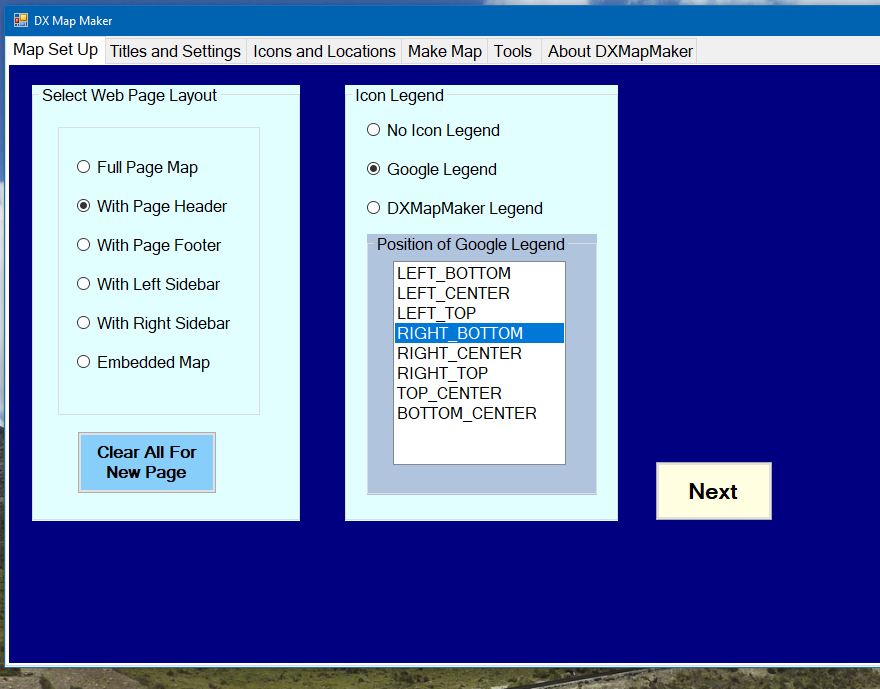
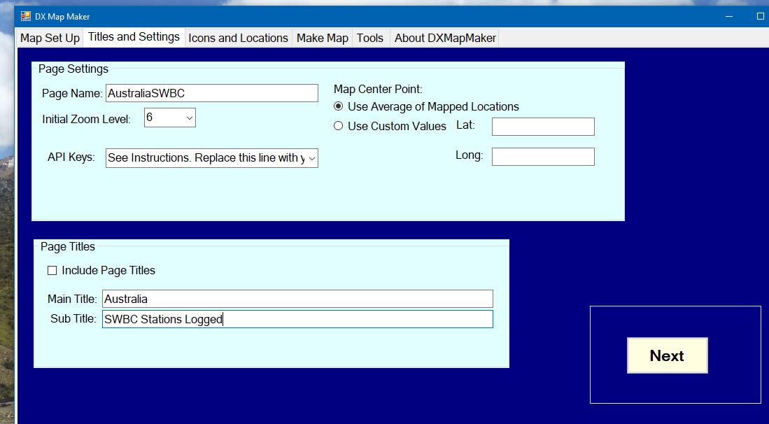
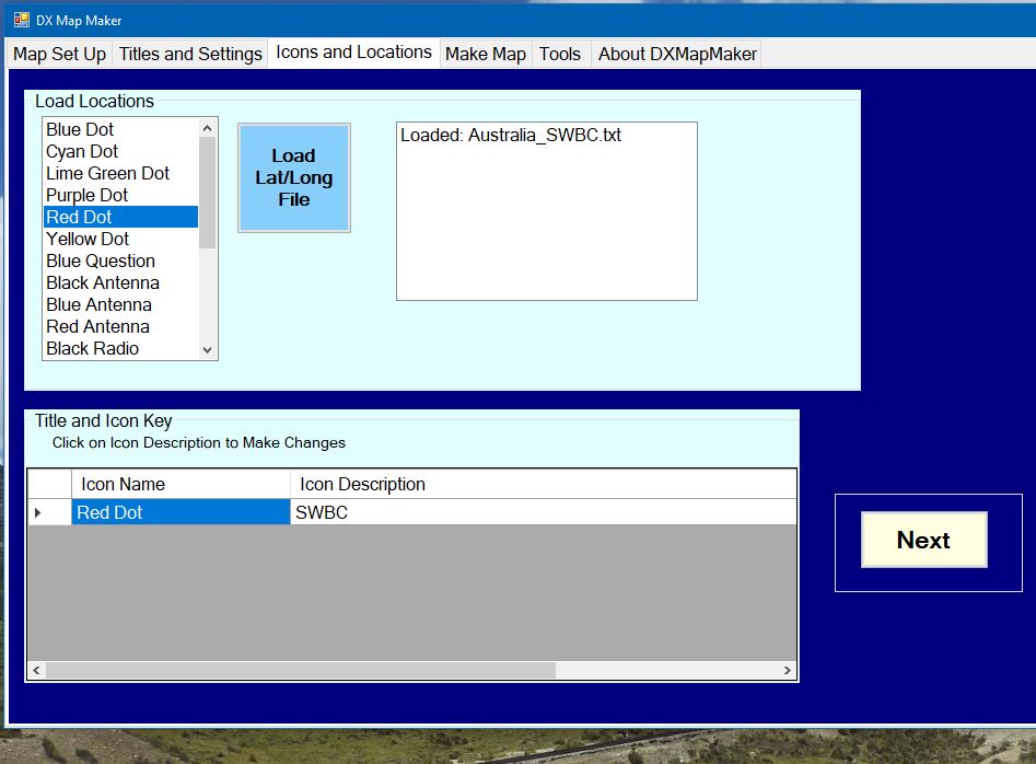
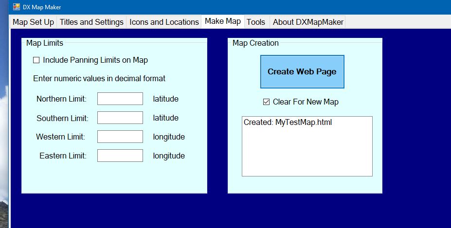
Finally, just go through the steps on the DXMapMaker application.